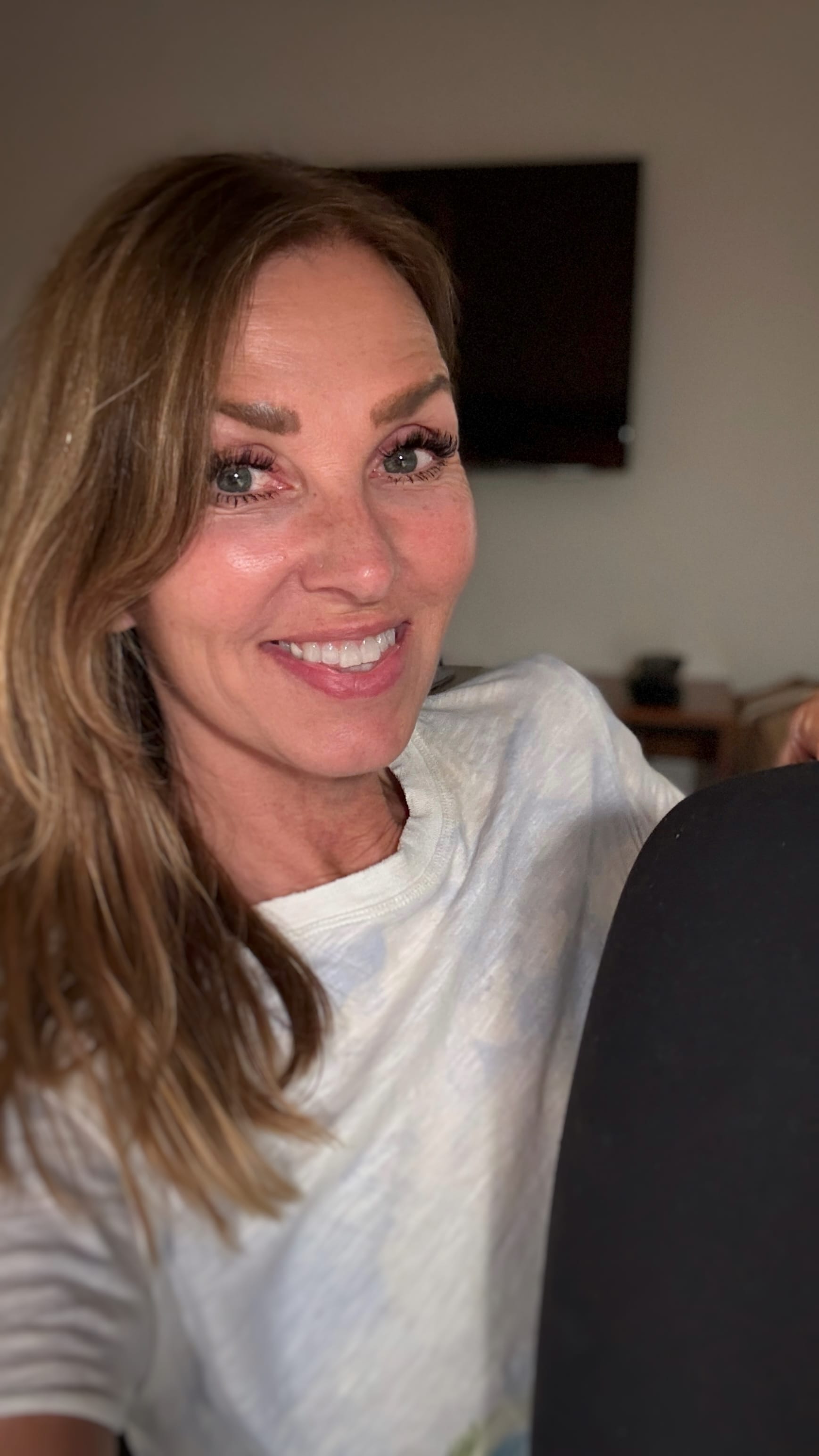
Hiking the Dingle Way: 9 Unforgettable Days Along Ireland’s Coast

I first visited Dingle back in 2008 and instantly fell in love. That trip made me realize I needed to come back—not just to the town itself, but to explore more of the peninsula. Then I heard about a long-distance hike that loops around the entire area, connecting one village to the next: The Dingle Way.

I couldn’t stop thinking about it. I wasn’t sure when I’d get the chance, but the idea of spending my days walking through mountains, across fields, and along wild beaches stuck with me.

The Dingle Way

Over the years, I kept hearing about The Dingle Way from other travelers, and every mention only made me want to do it more. Eventually, I decided to just go for it.

I booked the trip through Hillwalk Tours—a company I’d used the year before when I hiked the Rob Roy Way in Scotland. They handle everything: accommodations, baggage transfers, daily route guides. All I had to do was lace up my boots and walk. They offer different options depending on how hard or long you want to hike. I went for the moderate version—long enough to feel like a real adventure, but with time to stop, look around, and take it all in.

Each day averaged around 10.5 miles and brought us through breathtaking scenery and postcard-perfect villages. We stayed in cozy B&Bs where every morning began with a full Irish breakfast. And in the evenings, there was always a pub nearby for a pint and a hot meal.

Most B&Bs packed lunches for the trail, and for the ones that didn’t, Hillwalk suggested where to pick up snacks or sandwiches. They really did think of everything.

The Dingle Peninsula, on Ireland’s southwest coast in County Kerry, is about 30 miles long, and somehow it manages to feel both wide open and intimate at the same time. Every little village has its own character—and by walking through them, you get to experience it in a way that’s hard to do by car.

Dublin to Tralee

 We flew into Dublin and spent a few days exploring the city before catching the Irish Rail from Heuston Station to Tralee Casement Station—a ride of about four hours.

Tralee was where I’d officially begin the Dingle Way the next day.

(I share more about our time in the city in my post:  Exploring Dublin: A 3-Day Adventure).

The Dingle Way, Dingle Peninsula, Hiking
We arrived!

Tralee, the capital of County Kerry, is a mix of history and modern charm. Founded by the Normans in 1216, its character really shines through in the 18th-century architecture along streets like Denny Street and Day Place.

Fun fact: Tralee is home to the world-famous Rose of Tralee competition, where Irish women and those of Irish descent are celebrated for their personality and spirit—not just their looks. The event wraps up with a gala ball and a lively “midnight madness” parade led by the newly crowned Rose.

There were plenty of cabs waiting at the Tralee station. So, we hopped in one and headed to The Grand Hotel Tralee —lodging for the night. The hotel had old-world charm and a central location that made it easy to explore town on foot.

Cab drivers are always a wealth of information, so on the way to the hotel, I asked ours for a pub recommendation. He rattled off a few, but said his favorite was Sean Og’s Drinking Consultants. Aside from pouring a great pint of Guinness, he mentioned they usually had traditional music in the evenings—something I made a mental note of.

Once we got settled at the hotel, we headed over to Sean Og’s. As we walked in, the bartender and regulars were deep in conversation, with colorful language—especially the word “FUCK”—flying around like punctuation. I couldn’t help but laugh, realizing I’d found my kind of place—laid-back and full of life. And true to our cab driver’s word, they sure did pour a damn good Guinness.

The Dingle Way, Dingle Peninsula, Ireland, Hiking
Best Pub in Tralee

Sean Og’s doesn’t serve food, and I was getting hungry, so I asked the bartender where we should eat. He—let’s call him A, since I never caught his actual name—told us to come back later for live music at 9:30. But for now, he suggested a place with great chips: The Green Rooster, or as the locals call it, Greasie Jimmy’s.

How can you not want to eat at a place with a name like that?

Eager to try those famous chips (and maybe a veggie burger), we set off—but of course, I totally forgot the actual name of the place. So I asked a local if they knew where Greasie Jimmy’s was, and without missing a beat, he pointed us in the right direction.

The Green Rooster, aka Greasie Jimmy’s, has been in business since 1949, making it one of the longest-running family businesses in Tralee.

And the chips? Even better than expected. Not greasy at all.

The Dingle Way, Dingle Peninsula, Ireland, Hiking
Waiting for our fries and Veggie Burger
The Dingle Way, Dingle Peninsula, Ireland, Hiking
The famous fries

Later that night, we headed back to Sean Og’s for the live music. The band was incredible, and what was supposed to be a quick stop turned into a two-hour stay. It was the perfect way to wrap up our night in Tralee before starting the hike the next morning.

Tralee to Camp 

After a hearty Irish breakfast—coffee, eggs, and some of that famous brown bread—we set off from Tralee. The path followed the canal out of town, passing by the iconic Blennerville Windmill—the largest working windmill in the British Isles.

The Dingle Way, Dingle Peninsula, Ireland, Hiking
Blennerville Windmill

As we walked, we passed cows grazing (or just lounging) in the fields and saw loads of bright yellow flowering bushes—called furze—lining the trail and spilling across the green pastures. Stone walls crisscrossed the landscape, and sheep dotted the hillsides like it was a scene straight out of a postcard. I’ve seen sheep before, but somehow, they just look more right in Ireland (and Scotland too, for that matter).

The Dingle Way, Dingle Peninsula, Ireland, Hiking
Gorse growing along the stone wall
The Dingle Way, Dingle Peninsula, Ireland, Hiking

The trail was a mix of rugged, wet, and muddy patches—which, honestly, is par for the course in Ireland.

Our hike ended at The Junction, a pub conveniently located right across from Camp Junction House, our B&B for the night. After chatting with some locals, we found out that all the restaurants in Camp were closed on Mondays and Tuesdays.

Luckily, the bartender at The Junction came through—she offered to make us toasties, those wonderfully simple grilled cheese sandwiches with tomato and red onion. We returned later that evening to eat them, and honestly, they hit the spot.

The Dingle Way, Dingle Peninsula, Ireland, Hiking
Toasties and Guinness —what could be better?

Camp to Annascaul  

Today’s hike was about 10.5 miles, winding along old country roads, rocky farm tracks, and grassy hillsides. In some spots, the Emlagh River ran right alongside us, and off in the distance, the Slieve Mish Mountains added a dramatic backdrop. Stone walls zigzagged across the fields like they were scribbled by hand. I expected rain—it is Ireland, after all—but surprisingly, the skies held.

The Dingle Way, Dingle Peninsula, Ireland, Hiking

In the afternoon, we reached Inch Beach, a vast stretch of sandy shoreline—“gorgeous” doesn’t really cover it. I stood at the water’s edge, taking in the sound of the waves, the salty air, and the sheer beauty of it all.

The Dingle Way, Dingle Peninsula, Ireland, Hiking
Inch Beach

The second day’s hike ended in the village of Annascaul—best known as the birthplace of Antarctic explorer Tom Crean. After surviving both Captain Scott’s South Pole expedition and Shackleton’s ‘Endurance’ voyage, Crean came back to this quiet village and opened the South Pole Inn, where he lived until his death in 1938.

The Dingle Way, Dingle Peninsula, Ireland, Hiking
The famous South Pole Inn

We stayed at  The Old Anchor Inn, a cozy spot run by a lovely couple, right on the town’s Main Street—literally.

Annascaul is a small village with four pubs, and we managed to hit three of them (the fourth was closed that day). First up was the well-known South Pole Inn, where we had pints of Guinness, chips, a warm bowl of veggie soup—and some really good brown bread.

The walls were covered in photos from Tom Crean’s expeditions, giving the place a museum-meets-pub feel that somehow works perfectly.

The Dingle Way, Dingle Peninsula, Ireland, Hiking
You can see photos of Tom Crean hanging around the bar

Next, we headed to Patcheen’s Pub, where we ended up in a lively, laugh-filled conversation with two locals that somehow ended with them buying us a round. I still crack up when I think about it—it was completely absurd, like something out of Waking Ned Devine. (If you haven’t seen it, you should.)

Our third pub was Hanafins, where we cozied up by a glowing peat fire. The smell of the smoke—earthy and a little sweet—filled the room in the best way.  We swapped stories with some locals over yet another pint. Word is, they pour the best Guinness in town—and honestly, it lived up to the hype.

The Dingle Way, Dingle Peninsula, Ireland, Hiking
Hanafins

After learning that Tom Crean was buried at Ballynacourty Cemetery, we decided to walk the mile and a half to visit his grave. It took us out of the village and along a quiet country road that twisted more than we expected. There were no signs, and we took a few wrong turns. Just as we were about to give up, a local came along and pointed us in the right direction.

We made it to the cemetery just as the light was starting to fade. There was still enough to find his grave, and I’m really glad we made the effort. It felt like the right way to end the day.

The Dingle Way, Dingle Peninsula, Ireland, Hiking
The grave site of Antarctic Explorer Tom Crean. 1877-1938

Annascaul to Dingle

After a fabulous breakfast of pancakes and fresh fruit at our B&B, we set off, passing a statue of Tom Crean as we left town.

We followed winding back roads that eventually brought us down to the sea, where the ruins of Minard Castle came into view. Legend has it that the castle was built in the 16th century by the Knight of Kerry and once stood as a defense against Cromwell’s forces.  

The area around it felt lonely and exposed—harsh, even—but in a way that made it easy to imagine what life might’ve been like here centuries ago.

I walked along the stone beach beneath the ruins, where smooth, weathered rocks stretched out in every direction. The roughness of the landscape only made it more beautiful.

The Dingle Way, Dingle Peninsula, Ireland, Hiking
Minard Castle

Part of the trail passed right through people’s fields—like, actual working farmland. We followed narrow tracks lined with stone walls, and whenever we came to one, there’d be a little turnstile or a set of steps built into the stones so we could climb over. It felt a little strange at first—like we were trespassing—but that’s just how it works here. Bright yellow gorse spilled over the tops of the walls, wild and cheerful, as if it had been growing there forever.

The Dingle Way, Dingle Peninsula, Ireland, Hiking

Our third day’s hike ended in Dingle—the biggest village on the peninsula. The town has an easygoing, lively feel, with pubs on almost every corner, each with its own personality. There are about 50 pubs in town, so if you’re into music, food, or just a solid pint, you’ll have plenty to choose from. It’s the perfect place to do your own little pub crawl—and of course, catch some live trad music along the way.

But Dingle’s not all pubs. It’s also home to great restaurants, an aquarium, lots of little shops to explore, and a harbor where you can hop on a boat for whale watching or head out to the Blasket Islands.

One of the nice things about booking through Hillwalk Tours is that you can always add an extra day or two in any of the villages. I added a couple in Dingle—I’d taken a boat to the Blaskets years ago and knew I wanted to go again. It’s the kind of place that’s worth slowing down for.

You can read more about the Village of Dingle in my blog: Exploring Dingle: 3 Days of Adventure, Culture, and Charm.

The Dingle Way, Dingle Peninsula, Ireland, Hiking
Downtown Dingle

Dingle (actually, it was Ventry) to Slea Head/ Dunquin 

A section of the hike near Dingle was closed, so a driver from Hillwalk Tours took us to our starting point for the day.

The hike began with a peaceful stretch along Ventry Beach. The sound of the waves was almost hypnotic, and for a while, I just walked in silence, soaking it in. Gorgeous pink flowers—Armeria Maritima —lined the edge of the path, adding little bursts of color along the coast.

The Dingle Way, Dingle Peninsula, Ireland, Hiking
Ventry Beach

Eventually, the Dingle Way led us onto quiet country roads, bordered by lush green fields dotted with sheep. The ground was still wet from earlier rain, so there were snails everywhere—slow little hikers in their own right. Stone walls stretched across the landscape in every direction, and for most of the day, the sea stayed in view off to our left.

The Dingle Way, Dingle Peninsula, Hiking
Because the ground was so wet, we found lots of snails
The Dingle Way, Dingle Peninsula, Ireland, Hiking
It may not be easy to see, but that is actually the ocean in the distance

As we neared Dunquin, the trail followed a mountain path that ran alongside the ocean. I stopped a few times at the cliff’s edge just to take it all in—the sea felt endless, like it was just stretching out beyond everything.

The Dingle Way, Dingle Peninsula, Ireland, Hiking
Overlooking the Atlantic Ocean
The Dingle Way, Dingle Peninsula, Ireland, Hiking
Stone walls like these snake across Ireland's countryside. Known as dry stone walls, they are built without mortar or cement.
The Dingle Way, Dingle Peninsula, Ireland
The yellow flower bushes are known as Gorse.

At one point, I spotted a few old stone structures off to the side of the trail—small, circular buildings made entirely of stacked stone. They are called beehive huts or beehive cells, and were once used by early Christian hermits as simple dwellings or storage rooms. The roofs were long gone, but the craftsmanship was still obvious—built without mortar, just stone balanced on stone.

The Dingle Way, Dingle Peninsula, Ireland, Hiking
These are examples of Beehives but obviously missing their roofs
The Dingle Way, Dingle Peninsula

Today’s hike was one of the longer days—13.5 miles—and by the end, I was definitely feeling it. But honestly, that’s always a good thing for me. I like ending the day a little tired, knowing I earned that pint.

Eventually, the winding road led us to Krugers Pub, known as ‘the most westerly pub in Europe.’

As the social hub of the village, it wasn’t surprising to walk into a full-on bachelor party—complete with the groom-to-be hilariously dressed in a wedding gown. In the next room, a communion was underway, packed with kids, parents, and proud grandparents. The contrast between the two scenes totally cracked me up. Only in Ireland.

Slea Head/Dunquin to Ballyferriter 

 This stretch of The Dingle Way followed coastal roads with wide-open views of the Great Blasket Island, passing pristine beaches like Clogher Strand and Béal Bán Beach. As I neared the end of the hike, dark clouds gave way to heavy rain, leaving me cold and soaked by the time I reached Ballyferriter. But I’d prepared for rain with a rain jacket and pants, but unfortunately—those damn boots of mine were wet once again.
The Dingle Way, Dingle Peninsula, Ireland, Hiking

Cold and soaked, I ducked into a local pub—Tig An T Saoraigh —before heading to my B&B. The soup of the day was a hearty vegetable, served with brown bread, and it was exactly what I needed to warm up.

While I was finishing my meal, I got to chatting with the bartender. She told me her grandfather—a Guiheen—was one of the last people to leave the Great Blasket Island in the 1950s. She said parts of his old house are still standing out there.

The Dingle Way, Dingle Peninsula, Ireland, Hiking
Enjoying a bowl of soup and beer as I warm up

With the rain still coming down, we decided to make the best of it and hit every pub in town—four in total. Each one was packed with locals watching Gaelic football and cheering for the Kerry team, who won that day. Every pub had its own charm, and it was just plain fun being there—nursing an Irish coffee, staying warm, and soaking it all in.

The Dingle Way, Dingle Peninsula, Hiking
Locals enjoy a pint at Tigh Ui Chathain Pub

Hiked Ballyferriter to Cuas

Ballyferriter to Caus was one of those days I’ll remember—a quiet, beautiful stretch along the Dingle Way. Beaches, coastal roads, green cliffs, wide views… it had that kind of beauty you don’t even need to describe. You just walk through it.

The Dingle Way, Dingle Peninsula, Ireland, Hiking
The Dingle Way, Dingle Peninsula, Hiking

The cliffs were dotted with pink Armeria Maritima, adding vibrant pops of color to the rocky landscape. The farm fields were beautiful in every imaginable shade of green, stretched out like a patchwork quilt.

At one point, we veered off the trail to visit the Gallarus Oratory — an ancient stone structure that some what resembled a small, upturned boat.

Its walls were built without mortar, just carefully stacked stone, and the craftsmanship was both simple and incredible. Tucked into the rolling fields, surrounded by rugged scenery, the whole place had a quiet, peaceful feel to it.

Back on The Dingle Way, I walked along Muiríoch Beach, feeling the breeze on my face, listening to the waves crashing, and breathing in the salty air. I tried to take it all in.

The Dingle Way, Dingle Peninsula, Hiking
Gallarus Oratory
The Dingle Way, Dingle Peninsula, Ireland, Hiking

We stayed at Imeall na Mara House(which means Seashore House) in Ballydavid—overlooking Smerwick Harbor. There was only one pub nearby, An Bóthar Pub, and thankfully it was open—otherwise, we would’ve gone without dinner.

Hiked Southern Route: Glin North – Cloghane 

After spending the night in Ballydavid, our B&B host gave us a lift to the day’s starting point.

There are two options for this stretch of the Dingle Way: one that goes over Mount Brandon —the longer, steeper, more challenging route—and a slightly shorter one that crosses Masatiompan, a northern ridge of the same mountain range.

With the wind as strong as it was, we decided the lower route was the smarter call.

Even so, it wasn’t exactly easy. The trail climbed steadily through a pine forest and got rougher as we gained elevation. At one point, the wind was blowing so hard I had to crouch down just to keep from getting tossed around. We waited it out for a bit, then pushed on once it eased up. As we began to descend, the wind calmed, and the views opened up—green fields stretched out as far as I could see.

The Dingle Way, Dingle Peninsula, Ireland, Hiking
Heading out on today's hike

The forecast had called for rain, but we got lucky. The day started out with heavy clouds and strong wind, but by afternoon, the sky had cleared and turned a bright, brilliant blue.

Lough Gal and Lough Duff in the distance
Today's hike began on a trail with Pine trees.

The Slieve Mish Mountains loomed in the background for most of the hike, adding some real drama to the landscape.

At one point, we caught a glimpse of Lough Gal and Lough Duff off in the distance—two quiet, beautiful lakes tucked into the hills.

The Dingle Way, Dingle Peninsula, Ireland, Hiking
Lough Gal and Lough Duff in the distance
The Dingle Way, Dingle Peninsula, Hiking

As I got closer to Cloghane, the trail cut through wide open fields, and I started to notice stacks of peat bricks laid out to dry in the sun. In rural parts of Ireland, peat is still used for fuel—cut from bogs, then dried and burned in stoves or fireplaces for heat.

The Dingle Way, Dingle Peninsula, Hiking
Bricks of Peat drying in the sun
The Dingle Way, Dingle Peninsula, Hiking

When we finally reached Cloghane, located at the foot of Mount Brandon, we spotted O’Connor’s Pub and Guest House —with a purple facade that immediately caught my eye. We went in for a beer and a bowl of soup. The soup was great, but the real standout was the brown bread. It was darker than any I’d had on the trip, with a deep, molasses-like flavor. Absolutely fantastic.

While enjoying our lunch, we met the pub owner, who was friendly and engaging. He was also a great storyteller. One of the stories he shared was about a German Luftwaffe plane, a Focke-Wulf 200 ‘Condor,’ that crash-landed on Faha Ridge above Cloghane on August 20, 1940. The crew of six survived and were the first German aircrew to land in Ireland during the war; they were interned for the rest of the conflict. I loved listening to his stories. 

Oh, and that wrecked German Luftwaffe plane—the pub owner had parts of it displayed around his pub. He also had an Academy Award statue—but that’s another story.

The Dingle Way, Dingle Peninsula, Hiking
O'Connor's Pub is the purple-painted building in this photo

We stayed at the Mount Brandon Lodge B&B, a cozy place run by an older couple just down the road from O’Connor’s. While we were there, we met another couple—Candy and Al—who were also hiking the Dingle Way.

That evening, the four of us went back to O’Connor’s for dinner and a few drinks. We got treated to even more of the owner’s stories, which somehow got better with each pint.

Cloghane to Scraggane Pier

The next day’s hike was another one for the senses. The narrow, single-track roads led me out of town, over old stone bridges, and past quiet fields where sheep grazed like they had all the time in the world.

The Dingle Way, Dingle Peninsula, Hiking
Sheep are spray painted to help identify which sheep belong to which farmer and field

Eventually, I reached Fermoyle Strand—the longest beach on the Wild Atlantic Way. I couldn’t resist taking off my boots and dipping my toes into the icy water.

It was a highlight of the day. Golden sand, crashing waves, and that wide, open feeling you only get at the edge of the world.

The Dingle Way, Dingle Peninsula, Hiking
The water was freezing!

From there, I continued toward Scraggane Pier, my endpoint for the day.

Somewhere along Fermoyle Strand, I spotted a hag stone—also known as a fairy stone—sitting among the sand. These naturally holed stones are said to bring luck, and some believe they hold magical or spiritual power. Whether or not that’s true, it felt like a little gift from the trail.

The Dingle Way, Dingle Peninsula, Hiking
My magic Hag Stone

Scraggane Pier to Camp 

 Most of today’s hike was along the beach, with a few sections on narrow, one-lane country roads. At one point, I paused to listen to Mary Black‘s version of “Song for Ireland,” and I was overcome with emotion.

Standing on the rocks, looking out at the sea, I was completely overcome. I found myself in tears—moved not just by the beauty, but by everything that had built up over the past nine days: the people in each village, the quiet rhythm of walking, the small kindnesses, the landscape that never got old. This hike turned out to be so much more than I ever imagined.

The Dingle Way, Dingle Ireland, Hiking
The Dingle Way, Dingle Peninsula, Ireland, Hiking
Candy and Al -fellow hikers
The Dingle Way, Dingle Peninsula, Ireland, Hiking
Getting emotional as I take in the incredible views on my last day

After our long and final day of hiking The Dingle Way, we arrived at Camp (the name of a village) and headed to Ashe’s Coffee Shop—our designated pickup spot. Unfortunately, the coffee shop had just closed for the day, and we were so hoping for an ice-cold beer. The owner apologized and then left, returning a few minutes later with a plate of mini lemon meringue pies—they were delicious.

Shortly after, we were picked up and driven to Tralee, where we’d be staying the night.

The Dingle Way, Dingle Peninsula, Hiking
Little treat the cafe owner brought us

Our final evening was spent at Sean Og’s—still my pick for the best pub in Tralee. We raised our glasses of Guinness and shared laughs with Candy and Al, the fellow hikers we’d met back in Cloghane.

The atmosphere was lively and joyful, with a duo playing traditional Irish music that had the whole place buzzing. It felt like the entire village had come out to celebrate—not just the end of our hike, but something bigger. A kind of shared joy that didn’t need explaining.

The Dingle Way, Dingle Peninsula, Ireland, Hiking
Celebrating our last evening and a great hike

Before catching a taxi back to Dingle for a few more days of exploring, I took a quiet stroll around Tralee. As luck would have it, I found a little pub still open and couldn’t resist one last drink to cap off the trip.

And yes—it was a Guinness.

A perfect journey on The Dingle Way

My nine-day hike along The Dingle Way, covering 94 miles of the 111-mile trail, was unforgettable. From long, empty beaches to sheep-filled pastures and cliffside paths, each day brought something new. I met fellow hikers like Candy and Dan from North Carolina and swapped stories over pints in local pubs like O’Connor’s in Cloghane and Sean Og’s in Tralee.

Hillwalk Tours made everything seamless—great B&Bs, helpful notes, and smooth luggage transfers. They took care of the logistics so I could just focus on the walk. If I’m lucky, this won’t be my last Hillwalk adventure. I’m already dreaming about where to go next.

Related Posts:

 
  • Exploring Dingle: 3 Days of Adventure, Culture & Charm– A closer look at how I spent my extra days off the trail, including a boat ride to the Blasket Islands

  • Rob Roy Way: Walking Through the Heart of Scotland – Another long-distance walk with Hillwalk Tours—this time through the Scottish Highlands. (coming soon)